
Search a Rosemead Street by Address
A by-address search works from the physical parcel outward. Begin with the exact street string you have, including direction and suffix, and keep the original form in your notes. The address can identify an AIN, but it does not directly open the Los Angeles County deed index. The chain below separates parcel identity, ownership, permits, historical occupants, and voter evidence instead of blending them into one claim.
Use these steps for one property or a bounded stretch of a Rosemead street.
- Enter the situs address in the Los Angeles County Assessor Portal and save the AIN, map reference, legal description, and effective date.
- Open Map Search and click the target parcel and nearby parcels in house-number order, noting corner lots and shared addresses.
- Use the AIN or a lawful owner record to identify a likely deed party, then search the recorder by name and approximate year.
- Ask Rosemead Building and Safety or Planning for a defined address, permit, or entitlement record and date range.
- Move backward through the historical street directory and California voter registrations when the goal is a past household.
Note: A street address is a human-facing label; AIN, legal description, and recording number are stronger keys for separate record systems.
Rosemead Assessor Fields Turn Addresses Into Parcels
The Assessor Portal is the best current starting point for a Rosemead street directory because it accepts either an address or an AIN. Basic Search is a general route, Legal Search emphasizes legal-description information, and Map Search shows parcel geometry. The parcel card may include property type or use, legal or map reference, assessment values, building characteristics, tax-rate area, and a displayed effective date. Save the access date as well as the result because the roll changes.
| Search control | Rosemead address use | Limit |
|---|---|---|
| Search by AIN or Address | Finds the parcel from a 10-digit AIN or situs address. | It is not a name search. |
| Basic Search | Opens general assessment details. | Displayed fields can vary by parcel. |
| Legal Search | Helps compare legal description and map references. | It does not list all occupants. |
| Map Search | Allows a spatial browse of adjacent parcels. | Parcel shape is not a household count. |
| Assessor Internet | Shows the parcel detail route and effective-date context. | Mailing and situs addresses may differ. |
Use the AIN as a bridge to tax, deed, permit, and map records. A public web card may not display a public owner-name search. When an owner connection is needed, request the applicable assessment record through the Assessor's lawful channel rather than inventing a search feature.
- Parcel
- A defined piece of land represented by an AIN and legal or map description.
- Situs
- The physical location of the parcel, not the destination for a tax bill.
- Plat
- A recorded map that identifies a subdivision, lot, block, or tract relationship.
- Criss-cross directory
- A reverse directory organized by street address, often showing a printed occupant or business for a covered year.
Browse Rosemead Street Parcels by Block
Rosemead has no documented public button that returns every person on a named street. Recreate a bounded street browse spatially. Search one known address, zoom until parcel lines appear, click each lot, and record AIN and situs in house-number order. Include corner parcels whose official situs may use the cross street. Condominiums and multi-parcel developments can share or vary addresses, so parcel count never equals household count.
The Assessor Map is the correct first map for incorporated Rosemead parcels. For nearby unincorporated pockets, Los Angeles County GIS-NET Public supports address, AIN, and intersection search, layer identification, buffers, queries, tract and parcel-map selection, drawing, measurement, export, reports, and PDF printing. GIS-NET is designed for unincorporated territory, so it is not a substitute for City of Rosemead zoning or permit files.
Keep the map task separate from identity work. First draw the spatial boundary. Next write down the parcel keys. Only then decide whether a property, historical, planning, or civic record can lawfully add a name or organization. That order makes the street directory auditable and prevents a map label from becoming an unsupported resident claim.
For a visual reference to the county mapping tools, open the GIS-NET public page and compare its layer and buffer controls with the Assessor Map.
Note: GIS-NET's unincorporated coverage makes the incorporated Rosemead boundary a necessary field in every parcel comparison.
Rosemead Street Records by Source
Different record sets can be keyed to the same address, but each one describes a different relationship. The table is the working coverage map for a Rosemead street directory. Property and map systems identify land. Deeds identify recorded parties. Permits identify a project and its participants. Historical sources place people at an address in a defined year.
| Record set | Keeper | Street clue | Access |
|---|---|---|---|
| Assessment parcel | Los Angeles Assessor | AIN, situs, legal/map facts, values, building data | Free address or AIN portal |
| Assessor map | Los Angeles Assessor | Adjacent parcel geometry and neighboring AINs | Free map browse |
| Recorded deeds and liens | LA RR/CC | Parties, transfer, legal description, document date | Name/year index in Norwalk; copies ordered |
| Permits and planning files | Rosemead departments | Address, scope, applicant, contractor, hearing or final dates | Targeted office or CPRA request |
| Historical directories | LAPL | Printed occupant or business by address in covered volumes | Digitized and in-person collections |
| Historical voter register | Library database | Registered voter at a quoted address in covered years | Ancestry Library Edition in a library |
The Los Angeles recorder overview explains the office route and its offline index. A street directory should report whether a name came from title, assessment, a permit, a printed directory, or a voter source. Those labels preserve meaning.
Situs and Mailing Addresses in Rosemead
A situs address is where the parcel sits. A mailing address is where a tax bill or other notice goes. A legal description identifies the land through lot, block, tract, map, or metes-and-bounds language. These keys can point to the same property while describing different locations. When a mailing address matches the situs, it is evidence consistent with an owner connection. It still does not prove occupancy or identify every household member.
Preserve all three fields in a street directory note. Street names can be abbreviated, directions can move, and older sources can use a predecessor community name. The AIN and legal description are useful when a printed directory uses a different street format or when a boundary address appears in Temple City, San Gabriel, or an unincorporated county area.
Address discipline. Record the source's exact spelling, its date, and whether it is situs, mailing, legal, service, or project address evidence.
Note: A service or business address can connect a name to an organization without being that person's home address.
Why Rosemead Street Records Need a Name
The Los Angeles County RR/CC real-estate index is the major break in an address-first workflow. It covers records from 1850 or 1851 forward, but the grantor and grantee index is offline and cannot be searched by street address. The alphabetical search uses grantor, grantee, and recording year. At Norwalk, 1851 through 1957 records are on the lower level and 1958 through the present are on the second floor. Appointment, mail, and copy routes all remain important fallbacks.
Convert an address to an AIN, obtain a lawful owner or current deed clue, estimate the acquisition year, and search that person as grantee. Read the instrument number, recording date, legal description, grantor, and grantee. Then follow the grantor backward as an earlier grantee. A deed chain can establish title events, but it cannot establish who occupied the property on a particular day.
| Official records route | Commercial people-search category | |
|---|---|---|
| Custodian | Recorder, assessor, city, court, library, or state agency | Private compiler with mixed source quality |
| Strength | Shows a defined record, role, date, and jurisdiction | May combine names and stale address clues |
| Best use | Verify a property, family, civic, or historical lead | Only a secondary lead that needs custodian confirmation |
For current access instructions, use the recorder's real-estate viewing page before planning a Norwalk visit.
Rosemead Permit Requests by Address
Rosemead Building and Safety can add a physical-change timeline to a street directory. The public inspection request page exposes a Permit Number field for scheduling an inspection. It is not a comprehensive browse of permits and does not solve address discovery. For a known site, ask for permit history by address or AIN and date range, including permit number, description, applicant, contractor, issue date, inspection milestones, and final date where releasable.
Planning files can add development applications, ownership authorizations, site plans, and hearing packets. Code-enforcement records may show an address, violation date, status, and responsible party, but exemptions and redactions apply. A permit applicant may be an owner, contractor, architect, or agent, so the project role must remain attached to the name.
Rosemead's planning and zoning update work considered parcel-specific public hearing material in 2023 and 2024. Search Rosemead Building and Safety and the City Clerk's records platform for the current route. If the exact record is not posted, make a narrow California Public Records Act request.
Note: A permit history dates physical work and project roles; it does not establish who occupied the address during construction.
Reverse Rosemead Street Directory by Number
Historical directories turn an address into an occupant or business clue for a printed year. LAPL's digitized Los Angeles-area city and street-address collections cover selected years from 1875 through 1987 and support name or address searching. The image matters because OCR can misread narrow columns, initials, spacing, and non-English names. When a search fails, open the street section, normalize the suffix and direction, and scan house numbers in sequence.
Rosemead may appear under a regional title rather than a Rosemead-only volume. Check the title page and communities-included statement. A missing listing can reflect an unlisted household, a rural or newly included area, a name filed under a spouse, or a year outside coverage. It is not negative proof that nobody lived at the address.
The historical collection is the specialty of the Rosemead city directory page. This street directory keeps the narrower address method: preserve title, year, page image, printed abbreviation, and whether the entry is a household or business.
Search Historical Rosemead Voters by Quoted Address
California voter registrations from 1900 through 1968 provide a historical address bridge between directories and census schedules. In a library database, put the address in quotation marks when the search system supports a quoted-address phrase. The result represents a registered voter in a covered year, not every occupant, minor, nonvoter, or later household member.
Modern voter information has a different rule. My Voter Status is for the voter to check personal registration. Los Angeles County voter-file requests require a permitted statutory purpose, requester identity, delivery details, payment, certification, and signature. Do not describe a restricted voter file as a casual Rosemead street directory.
Compare historical voter entries with the address in a directory, a census schedule, or a deed only after checking dates and names. A current absence can result from list maintenance, an address change, or a confidentiality program. Keep the source and year beside every voter clue.
Limits of a Rosemead Street Directory
No public street directory captures everyone connected with an address. The assessor may show a parcel and a mailing clue, but not all occupants. A deed shows a recorded party, not move-in date. A directory shows a printed snapshot. DMV address data is restricted by the Driver's Privacy Protection Act, utility and delivery customer data is not an open household list, and Safe at Home participants or protected voters may be suppressed.
Define the result before using it. A street profile can describe parcel geometry, public project contacts, recorded ownership events, historical occupants, or qualified civic data. It should not be presented as a current roster. When an identity question becomes personal, move to the separate record-by-record verification path and contact the custodian for confirmation.
Lawful use. Rosemead address records support personal research, family history, property curiosity, and civic transparency. Do not use an address trail to stalk, harass, intimidate, or harm another person.
For a delivery boundary or address-format check, the USPS address and ZIP lookup is the proper postal source. It verifies mail geography, not household identity.
To see the postal form itself, the manifest capture below links directly to the official lookup.
Open USPS ZIP Code Lookup before reading the Rosemead street capture.
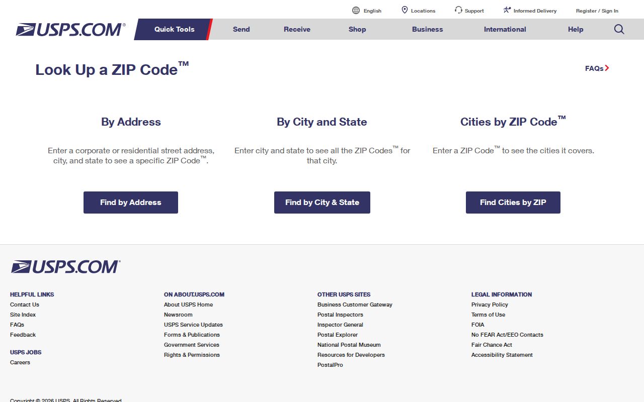
The USPS capture shows why a standardized mailing address is a useful first check. It still answers delivery geography, not who occupies a parcel.