
Looking Up Rosemead Neighbors Around One Address
Define the block before opening a map. A useful boundary can be both sides between two cross streets, or a stated GIS buffer around one AIN. The first approach is easy to explain; the second is useful when parcels are irregular or a boundary line matters. Start with parcel geometry and source access, then decide which public record can add context.
| Source | What it shows about a block | Access |
|---|---|---|
| Assessor Map Search | Parcel lines, situs addresses, AINs, and public parcel facts | Free county map |
| GIS-NET Public | Adjacent unincorporated parcels, zoning, districts, buffers, and measurements | Free county viewer for unincorporated territory |
| Historical street directory | Printed occupants or businesses along a numbered street in a covered year | LAPL digitized collection |
| Historical voter register | Registered voters at a quoted address for covered years | Library database |
| Modern voter file | Qualified-purpose registration fields | Approved application only |
| Planning or agenda packet | Applicants, owners, project contacts, and parcel exhibits | City Document Central or request |
That coverage table is deliberately not a neighbor roster. It says what a source can reveal about a block and how a reader reaches it. A parcel result is not an occupant result, and a public organization contact is not a member directory.
Click Rosemead Block Parcels Around an Address
Use the Los Angeles County Assessor Portal to search the target address or AIN. Switch to Map Search, zoom until parcel lines are clear, and click the adjacent parcels one at a time. Record AIN, situs, map reference, and access date. Include a corner parcel whose official situs may be on the cross street, and flag multi-parcel developments or shared numbers.
- Write the target AIN and define the block or buffer boundary.
- Click each adjacent parcel in a clockwise or house-number order.
- Separate incorporated Rosemead parcels from nearby city or county territory.
- Use planning, permit, deed, or historical sources only after the parcel keys are stable.
- Report the source and role, not a merged current-person conclusion.
This process is spatial first. It supports a civic or property question without copying a private household list. A full named-street chain belongs on the Rosemead street directory page; a block lookup stops at the defined radius or cross streets.
Note: A block boundary should be written before names or project contacts are added, so the lookup remains spatially reproducible.
Rosemead GIS-NET Block Edges
Los Angeles County GIS-NET Public is useful when a Rosemead-area block touches unincorporated territory. Its research fields and tools include address, AIN, and intersection search, layer identification, query, buffer, tract and parcel-map selection, drawing, measurement, export, report, and PDF print. It can show nearby county zoning and district context that does not belong to an incorporated Rosemead parcel.
State the buffer distance or cross-street boundary in the note. A radius can cross a freeway, waterway, city line, or large parcel. GIS-NET is expressly for unincorporated territory, so a county layer should not be read as City of Rosemead zoning, permit authority, or a current neighbor list.
Open the GIS-NET Public viewer information before relying on a county layer. Timestamp the map because parcel splits, assessor effective dates, and planning layers can change.
- Buffer
- A stated distance around a point or parcel used to select nearby map features.
- Adjacent parcel
- A parcel sharing a boundary or immediately touching the defined block area.
- Layer
- A map category such as parcel, zoning, district, or other geographic data.
Build a Rosemead Block List From AINs
AINs are a safer organizing key than names. Create one row per parcel with AIN, situs, source, date, and public fact. Add a deed party only when a lawful county record supports it. Add a permit applicant or planning contact only with its project role. A historical occupant belongs in a separate year column. This structure prevents a block map from becoming an unverified list of current neighbors.
| Block worksheet field | Why it belongs |
|---|---|
| AIN and situs | Identifies the parcel and its physical address. |
| Boundary definition | Shows between-cross-streets or buffer scope. |
| Source and access date | Shows where the fact came from and when it was seen. |
| Record role | Separates owner, applicant, contractor, occupant, voter, or organization. |
| Confidence or gap | Preserves uncertainty, suppression, missing years, and conflicting clues. |
Official maps and custodial records have a defined purpose and date. Commercial people-search tools can mix public and private data, conflate names, charge for stale results, and preserve an old address after the source changed. They are not a substitute for the Assessor, recorder, city, court, library, or state custodian.
| Approach | Strength | Risk |
|---|---|---|
| Official parcel and record route | Defined source, role, jurisdiction, and date | May omit occupants or require an in-person request |
| Commercial compiled category | May surface a secondary clue quickly | Stale addresses, mixed identities, cost, and unclear provenance |
Note: AINs organize adjacent parcels without implying that every parcel has a publicly identifiable current neighbor.
Rosemead Historical Block Entries
For a historical block, choose one LAPL directory edition and transcribe the street-address section in numerical order. Mark vacant lots, businesses, no-return notes, initials, and abbreviations as printed. Compare the next available edition to see which entries changed. Do not combine occupants from several years into a simultaneous list.
The digitized Los Angeles-area collection covers selected years from 1875 through 1987. OCR can fail on columns and names, so browse the image when a house number or street spelling does not search. Check the title page and communities-included statement because a regional volume may not include every Rosemead block.
A historical block can also use California voter registrations from 1900 through 1968, searchable by quoted address through a library database. That source covers registered voters in a year, not all residents. The 1940 and 1950 census schedules add household relationships when the address or enumeration district can be matched.
Rosemead Voter Limits by Block
California's My Voter Status is a self-check for the voter. It can show status, party preference, districts, vote-by-mail status, and election information after identifying fields are supplied. It is not a public neighbor browser. Los Angeles County voter-file requests require requester identity, organization, file or geography, statutory purpose, payment, certification, and signature under the approved-use rules of Elections Code §§2188 and 2194.
Home address, signature, full birth date, driver-license or Social Security identifiers, and protected-voter data are not an unrestricted block directory. Safe at Home participants may register confidentially. A missing name can reflect suppression, list maintenance, an address change, or the fact that a person was never a registered voter. Do not reverse-engineer the gap.
For historical work, use the library's California Voter Registrations 1900–1968 collection and keep the printed or indexed year beside the address. For current status, direct a person to California My Voter Status.
Note: A voter entry represents a registered voter in a defined year, not every person connected with a Rosemead block.
Rosemead Neighbor Planning Packet Contacts
Rosemead Document Central and planning records can identify applicants, owners who authorize a project, consultants, speakers, parcel exhibits, and hearing dates. These records are useful for civic history and property research around a block. They are not a household roll. A project contact can be an architect, contractor, agent, or organization rather than a person who lives nearby.
Use a targeted request when a packet is not posted. Ask for a defined project, address or AIN, record type, and date range under the California Public Records Act. The city platform accepts a guest request or account, and prior released files can be searched before filing. Exemptions and redactions can remove names or personal details.
Rosemead's 2023 General Plan and zoning update and December 2024 land-use work create recent hearing and parcel-document trails. Search the Rosemead public records platform and the city planning update route for current files.
Rosemead Neighbor Community Contacts, Not Rosters
Public organizational contacts can help explain a block's community layer. Friends of Rosemead Library, Rosemead Chamber and business listings, school district or alumni resources, city commissions, and local community groups can identify public points of contact. The research did not verify an official citywide HOA or neighborhood-association inventory that publishes member households.
Do not imply that a congregation, block-watch, school, chamber, or association roster is public. Use a published organizational address or contact route, ask for consent, and keep a member list out of a compiled neighbor result. A public meeting agenda can show a speaker or applicant, but it does not reveal everyone connected to the block.
California's public-records guidance explains that a request is for existing records held by an agency. Read the California Secretary of State public-records FAQ before asking a city or county office to create a new neighborhood roster. For county-held records, use the RR/CC public-records request portal.
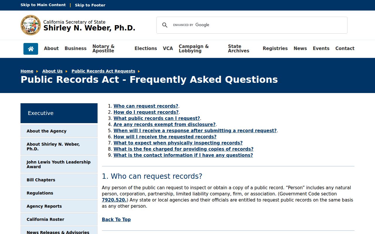
The public-records FAQ capture shows why a block research request should name an existing document, date range, address, or parcel instead of asking for a new list of neighbors.
Note: A public contact identifies an organization or project role, not the private households that may surround its meeting place.
Rosemead Neighbor Parcel Roll Gaps
Rosemead's owner-occupied rate was 47.3 percent in 2020 through 2024, and the average household size was about 3.42 persons. A parcel record can therefore identify a nonresident owner while missing the people connected to the address. A permit can identify a contractor, and a directory can identify one printed occupant, without either being a complete block list.
For current neighbor questions, publish the method and official source links rather than a compiled roster of private people. A parcel map, public planning contact, historical street page, and agency request can serve civic and property curiosity with less risk of exposing protected individuals. State the date and boundary so the block result cannot be mistaken for a permanent list.
Parcel splits, assessor effective dates, and map layers change. Recheck the source when a result matters, and preserve a prior capture only as a dated research note.
Privacy Limits on a Rosemead Neighbor Lookup
DMV personal address information is restricted by federal law. Utility customer and delivery data are not open household directories. Safe at Home participants, protected officials, protected voters, minors, and sealed or confidential case participants may be suppressed. The absence of a name should remain unexplained rather than becoming a reason to search harder for a private address.
Define the purpose before opening a source. A Rosemead neighbors lookup can map adjacent parcels, explain a planning project, compare historical block entries, or locate a public organization. It should not assemble a current private-person roster from mixed records. When a personal question needs confirmation, use the custodian's lawful request route and preserve the source role.
Lawful block research. Use public parcel and organizational information for family history, property curiosity, civic transparency, and community contact. Do not use a neighbor lookup to stalk, harass, intimidate, or harm anyone.
End the block worksheet with the boundary, AINs, sources, dates, and unresolved gaps. That is more accurate than claiming to know everyone around a Rosemead address.